 5.3 Generated Flight Line Survey
5.3 Generated Flight Line Survey
| TOC| Program Guide | Geological Modelling | Geological Visualisations | Geophysical Modelling |Geophysical Visualisations | Tools | File Formats | Tutorials | Index | Bugs |
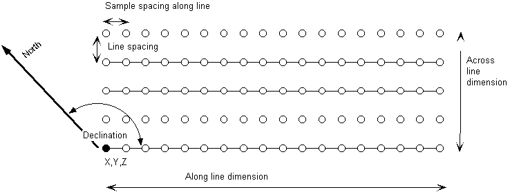
As an alternative to dense raster geophysical calculations, it is possible to calculate the geophysical response along real or synthetic flight lines. A rectangular area is defined with arbitrary declination, and then the line spacing and sample spacing along lines can be defined.
Flight Line Geometry
|
GROUP |
NAME |
FUNCTION |
|
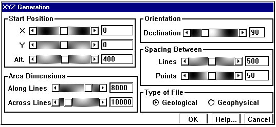
Position |
X |
X Position of South West corner of survey |
|
Y |
Y Position of South West corner of survey |
|
|
Z |
Z Position of South West corner of survey |
|
|
Orientation |
Declination |
Declination of flight lines |
|
Area Dimensions |
Along Lines |
Total extent of survey along lines |
|
Across Lines |
Total extent of survey across lines |
|
|
Spacing Between |
Lines |
Spacing of flight lines |
|
Points |
Spacing of samples along lines |
|
|
Type of File |
Geological |
File stores a simple ASCII tab delimited file showing for each sample point the raw rock property information at the surface of the block. |
|
Geophysical |
File store the calculated gravity and magnetic measurements for each sample point. |