
The Noddy modelling system allows you to rapidly build complex 3D geological models and calculate the resulting gravity and magnetic fields. Its primary use is in teaching, although of course it does allow you to try out simple geological scenarios as well.


How Noddy Works
In order to characterise the complex three dimensional structures that often cause geophysical anomalies it is necessary to have some understanding of the structural history of an area. The basis for this program is the ability to construct a complex geological history as a succession of relatively simple structural, sedimentary and igneous events.
Each geological history is defined as a sequence of kinematic events, and each event is defined by a set of orientation, position and scaling parameters. The structural modelling used in this program were first written by M Jessell as part of an MSc at Imperial College, London University, in 1981, as an interactive map creation package, and later commercialised by Encom after geophysical modelling capabilities and many other changes were made as part of an industry funded AMIRA collaboration between Monash University and the CSIRO. (Encom has since been taken over and the new company does not and will not support the version available here, so please don't ask them).

The program consists of introducing geological events to effect an infinite volume of rock. The displacement equations are defined explicitly or implicitly with respect to flat planes, so that the curvature of the earth is ignored. The displacement equations within this program are all unary, that is there is a one to one mapping of all points before and after each deformation event. The user is protected from these equations and is instead asked to describe the deformation in "normal" structural terms, such as strike and dip.
Downloads & Resources

Precompiled version for Windows.
Precompiled version for MacOS.
Precompiled version for Ubuntu 20.04. Requires installation of Qt libraries
As of 4/11/2009 this version installs all the manuals and example files, and is an Open Source equivalent to the final commercialised version.

Does not require any non-open source libraries, uses Qt5 for GUI. Compiles under gcc for Windows, MacOS & Ubuntu.
Does not require any non-open source libraries, but has no GUI. Compiles under gcc. Comes with python wrappers (part of pynoddy package).

Interactive HTML documentation

The missing pages 19-25 refer to licensing issues that are no longer relevant! Does not reflect recent changes
Step-by-step tutorial guide

Example files to accompany the tutorials

Comprehensive suite of models available for download from the Journal of the Virtual Explorer Volume 5
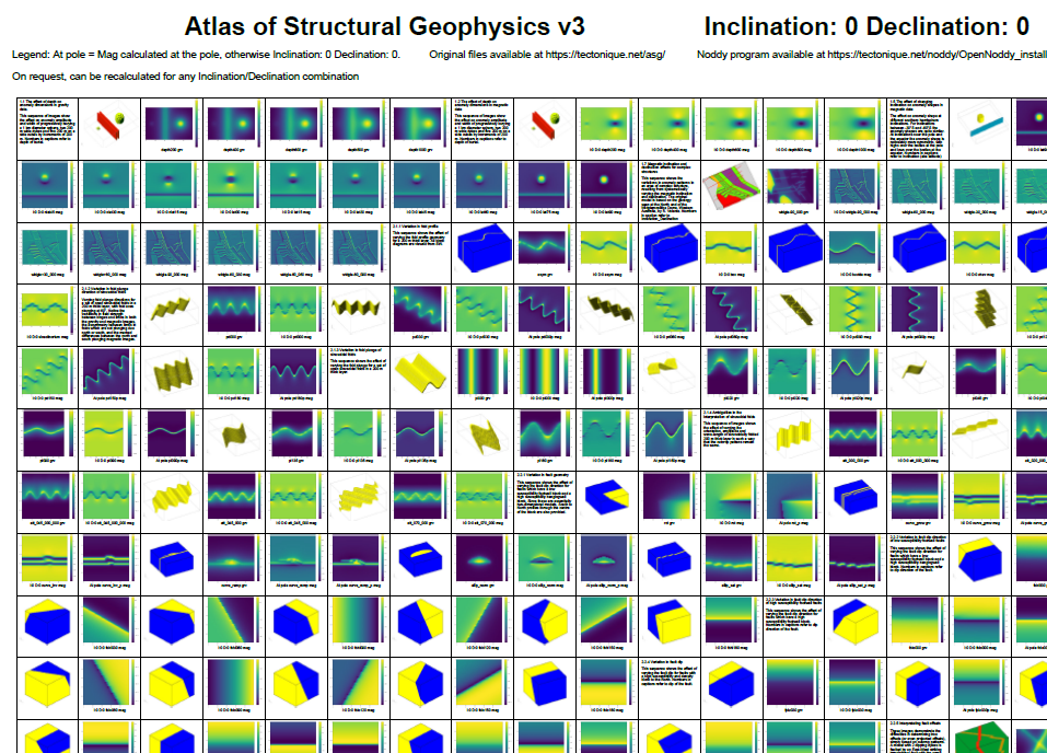
Single A0 Poster of the Atlas of Structural Geophysics with mag calculated at the equator and the pole
Publications that use Noddy
- Abbassi, B., 2018. Integrated imaging through 3D geophysical inversion, multivariate feature extraction and spectral feature selection. link
- Armistead, S.E., Betts, P.G., Ailleres, L., Armit, R.J., Williams, H.A., 2018. Cu-Au mineralisation in the Curnamona Province, South Australia: A hybrid stratiform genetic model for Mesoproterozoic IOCG systems in Australia. Ore Geology Reviews 94, 104–117. link
- Armit, R.J., Ailleres, L.A., 2010. Understanding the limitations provided by unconstrained potential‐field inversions on 3D models. A case study from Mount Painter Inlier, SA. link
- Armit, R.J., Betts, P.G., Schaefer, B.F., Ailleres, L., 2012. Constraints on long-lived Mesoproterozoic and Palaeozoic deformational events and crustal architecture in the northern Mount Painter Province, Australia. Gondwana Research 22, 207–226. link
- Azevedo, L., Narciso, J., Soares, A., Pereira, M.J., Vargas-Guzmán, J.A. (Eds.), 2025. International Geostatistics Congress 2024, Quantitative Geology and Geostatistics. Springer Nature Switzerland, Cham. link
- Bargman, S., Busuttil, S., 2003. The geophysics of the White Dam deposit, near Olary, South Australia. ASEG Extended Abstracts 2003, 127–134. link
- Biasi, J., Tivey, M., Fluegel, B., 2022. Volcano Monitoring With Magnetic Measurements: A Simulation of Eruptions at Axial Seamount, Kīlauea, Bárðarbunga, and Mount Saint Helens. Geophysical Research Letters 49, e2022GL100006. link
- Brisson, S et al. , D.A., 2025. Combining 3-D Probabilistic Kinematic Modeling With Thermal Resetting Measurements: An Approach to Reduce Uncertainty in Exhumation Histories. G cubed . link
- Christoforou, C., A. Stampolidis, G.N. Tsokas, P. Tsourlos, V. Lambos and A. Mpatsi. 2018. A High-Resolution Ground Magnetic Survey at Rizo’s Chromite Mine, Mt. Vourinos, N.Greece link
- Clark, D.A., 2014. Magnetic effects of hydrothermal alteration in porphyry copper and iron-oxide copper–gold systems: A review. Tectonophysics 624–625, 46–65. link
- Clark, D.A., Geuna, S., Schmidt, P.W., 2004. Predictive magnetic exploration models for porphyry, epithermal and iron oxide copper-gold deposits: Implications for exploration. link
- Farrell, S.M., Jessell, M.W., Barr, T.D., 1996. Inversion of geological and geophysical data sets using genetic algorithms. SEG Technical Program Expanded Abstracts 1996, 1404–1406. link
- Guo, J., Li, Y., Jessell, M.W., Giraud, J., Li, C., Wu, L., Li, F., Liu, S., 2021. 3D geological structure inversion from Noddy-generated magnetic data using deep learning methods. Computers & Geosciences 149, 104701. link
- Harris, E., Jessell, M., Barr, T., 1996. Analysis of the Euler deconvolution technique for calculating regional depth to basement in an area of complex structure. SEG Technical Program Expanded Abstracts 1996, 1373–1376. link
- Hart, S., 2024. Estimating remanent magnetization from aeromagnetic data for geologic applications. link
- Holden, D.J., Archibald, N.J., Boschetti, F., Jessell, M.W., 2000. Inferring Geological Structures using Wavelet-Based Multiscale Edge Analysis and Forward Models. Exploration Geophysics 31, 617–621. link
- Horrocks, T., Holden, E.-J., Wedge, D., Wijns, C., 2018. A nonparametric boundary detection technique applied to 3D inverted surveys of the Kevitsa Ni-Cu-PGE deposit. GEOPHYSICS 83, IM1–IM13. link
- Iasky, R.P., Mory, A.J., Blundell, K.A., 2001. The geophysical interpretation of the Woodleigh impact structure, Southern Carnarvon Basin, Western Australia. Report / Geological Survey of Western Australia. Geol. Surv. of Western Australia, East Perth, WA.
- Jessell, M., 2001. Three-dimensional geological modelling of potential-field data. Computers & Geosciences 27, 455–465. link
- Jessell, M., 1981. "NODDY"- An interactive map creation package. link
- Jessell, M., Guo, J., Li, Y., Lindsay, M., Scalzo, R., Giraud, J., Pirot, G., Cripps, E., Ogarko, V., 2022. Into the Noddyverse: a massive data store of 3D geological models for machine learning and inversion applications. Earth Syst. Sci. Data 14, 381–392. link
- Jessell, M.W., Valenta, R.K., 1996. Structural geophysics: Integrated structural and geophysical modelling. Computer Methods in the Geosciences, Elsevier, 303–324. link
- Kamath, A.V. 2023. Inversion of potential field data using the Petrophysically and Geologically Guided Inversion (PGI) Approach
- Lesage, G., Byrne, K., Morris, W.A., Enkin, R.J., Lee, R.G., Mir, R., Hart, C.J.R., 2019. Interpreting regional 3D fault networks from integrated geological and geophysical data sets: An example from the Guichon Creek batholith, British Columbia. Journal of Structural Geology 119, 93–106. link
- Lim, X. 2021. A fluid-flow modeling approach for predictive mapping of orogenic gold mineralization in the Malartic camp, Canada link
- Lindsay, M., Occhipinti, S., Laflamme, C., Aitken, A., Ramos, L., 2020. Mapping undercover: integrated geoscientific interpretation and 3D modelling of a Proterozoic basin. link
- Markov, J., 2016. Understanding the Influence of Noise on Aeromagnetic Data Interpretation Tools: Application to Structural Interpretation of the Siguiri Basin, Guinea, West Africa. link
- Meixner, A.J. and Gunn, P.J. 1997. Three-dimensional kinematic modelling of the magnetic field of the southern Joseph Bonaparte Gulflink
- Parquer, M.N., De Kemp, E.A., Brodaric, B., Hillier, M.J., 2025. Checking the consistency of 3D geological models. Geosci. Model Dev. 18, 71–100. link
- Perrouty, S., Aillères, L., Jessell, M.W., Baratoux, L., Bourassa, Y., Crawford, B., 2012. Revised Eburnean geodynamic evolution of the gold-rich southern Ashanti Belt, Ghana, with new field and geophysical evidence of pre-Tarkwaian deformations. Precambrian Research 204–205, 12–39. link
- Pollack, A., Cladouhos, T.T., Swyer, M.W., Siler, D., Mukerji, T., Horne, R.N., 2021. Stochastic inversion of gravity, magnetic, tracer, lithology, and fault data for geologically realistic structural models: Patua Geothermal Field case study. Geothermics 95, 102129. link
- Rashidifard, M., 2023. The integration of regional reflection seismic profiles and gravity datasets with different spatial coverage associated with geological models. link
- Smith, L., 2023. Potential Field Geophysics Enhancement Using Contemporary Deep Learning. link
- Strom, T. 2018. A geophysical study of the Mertainen area. link
- Thiele, S.T., Jessell, M.W., Lindsay, M., Ogarko, V., Wellmann, J.F., Pakyuz-Charrier, E., 2016a. The topology of geology 1: Topological analysis. Journal of Structural Geology 91, 27–38. link
- Thiele, S.T., Jessell, M.W., Lindsay, M., Wellmann, J.F., Pakyuz-Charrier, E., 2016b. The topology of geology 2: Topological uncertainty. Journal of Structural Geology 91, 74–87. link
- Vashisth, D., Pollack, A., Mukerji, T., Siler, D., 2023. Stochastic Inversion of Gravity and Magnetic Data to Build Subsurface Geological Fault Models Using Evolution and Swarm Intelligence-Inspired Optimization Algorithms. link
- Wellmann, J.F., Thiele, S.T., Lindsay, M.D., Jessell, M.W., 2016. pynoddy 1.0: an experimental platform for automated 3-D kinematic and potential field modelling. Geosci. Model Dev. 9, 1019–1035. link
- Wong, J.C., Holden, E.-J., Kovesi, P., 2013. CET exSim: Mineral Exploration Experience via Simulation. ASEG Extended Abstracts 2013, 1–4. link
License
As of May 2009 this software is no longer subject to a commercial release, and hence is freely distributable (and hence is no longer the object of professional support, you get what you pay for!).
This software is provided 'as-is', without any express or implied warranty. In no event will the authors be held liable for any damages arising from the use of this software.
Permission is granted to anyone to use this software for any purpose, including commercial applications, and to alter it and redistribute it freely, subject to the following restrictions:
1) The origin of this software must not be misrepresented; you must not claim that you wrote the original software. If you use this software in a product, an acknowledgment in the product documentation would be appreciated but is not required.
2) Altered source versions must be plainly marked as such, and must not be misrepresented as being the original software.
3) This notice may not be removed or altered from any source distribution.